
A brave new world in ranch management — remote sensing, GIS, GPS, drones, network analysis.
It does not replace your work, but it makes it more efficient.
By Michael Barnett
Land and water are the most important components of cattle and wildlife operations and there are a host of tools — both ‘tried and true’ and ‘gee whiz’ technologies — that can help you get the most out of these natural resources.
The face of livestock production is continuing to diversify and change as the realities of new economics and changing demographics set in.
“In the past, you had a ranching operation or a cattle operation,” says Dr. Humberto Perotto, assistant professor, and research scientist in landscape ecology at the Caesar Kleberg Wildlife Research Institute in Kingsville. “Now people are potentially doing livestock, and on top of livestock, wildlife, and on top of the wildlife, they have energy.”
That means owners and managers need to be smarter and willing to consider new approaches as they seek efficiency in managing their natural resources to put more money in the bank.
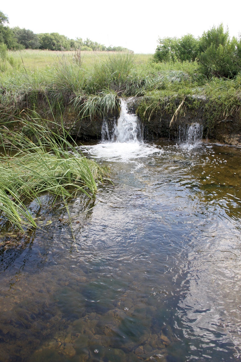
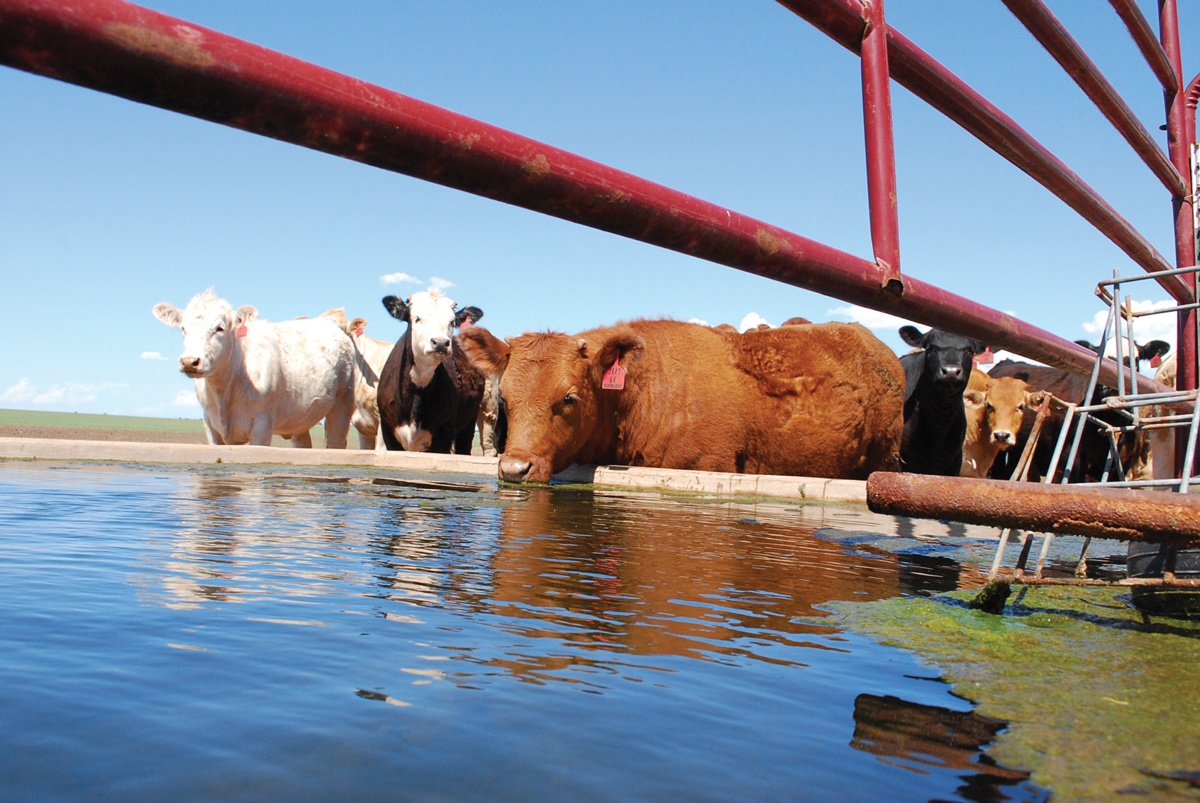
Water, water anywhere?
Take water, for example. Finding sources of underground water is always a gamble. A test well drilled in a pasture without a water source may be unsuccessful. Another test well at a different location may also turn up dry.
But there is a way to increase the chances of drilling successful wells. It is not a new technology, but it is one that many ranchers have not considered.
It is called seismic technology and has been adapted from techniques used in the energy industry to find oil and gas. Seismic technology can be used to conduct groundwater surveys prior to drilling a well. Analysis and interpretation of data gathered by the groundwater survey are compiled in a report, giving the landowner a scientific basis to determine the feasibility of drilling a well.
“So, if we detect groundwater, we will be able to tell the approximate depth and estimated yield range where we collect data on the property,” says Gerald Burden, owner of Fort Worth-based American Water Surveyors.
Burden’s crew does that by generating seismic energy, called a sounding, that they send down in the earth. Depending on how big an area needs to be surveyed, a series of soundings may be taken, depending on the rancher’s needs and his budget.
Burden says that a sounding is equivalent to a test well sunk by a driller. His company gathers data at sounding locations by using an instrument that sends pulses through the earth. Those pulses are then sent to a console for the user to investigate. Since water changes the pulses, the findings can represent the location and depth of the water.
Data gathered at one location is then compared to data from other soundings. A comparative analysis is conducted in terms of depth and yield or if groundwater was detected at all. This gives the rancher the ability to select the best location for the driller to sink a well.
“That way they are not guessing as to where to go on the property but are able to use some scientific data and a written report that we provide to make an intelligent decision on where to drill,” Burden says.
Cost, of course, is a huge factor in any management decision. He says that some ranchers were skeptical of seismic technology.
“But pretty much everyone is interested in drilling a successful well, particularly if they have firsthand experience with drilling a dry well,” he says. “The expense of drilling a dry well is that drillers get paid by the foot whether they get water or not, and that can be a bitter pill to swallow.”
Burden says the cost of four soundings would be equivalent to the cost of drilling one or two test wells.
There are some limits to the technology. Very rocky conditions two or three feet deep in the soil can create problems.
“The electrodes we put into the ground will distort the data if they are in contact with more rock than they are soil,” Burden says.
Overhead or underground power lines within 100 to 200 feet of a sounding can also be a problem. The other factor that could affect the ability to collect good data is groundwater that is high in saline content.
“High saline content has a tendency to short the electrical signal, the electrical flicker we are trying to pick up,” he says. “So, one of two things would happen. The yield would be underestimated because of the weaker signal or we may not pick it up at all.”
‘Gee whiz’ technology for land management
And then there is land management. Ranchers are used to eyeballing their land from ground level and making decisions on best management practices from what they see. Entirely different aspects open up, however, when the rancher takes a bird’s eye view of his land.
That is the thought behind geospatial technology. Experts say the information that can be gathered by the big picture view of the ranch from above can become invaluable in decision making.
It has opened up a brave new world in ranch management which at first glance seems full of scary terms and unknown technologies. Remote sensing. GIS. GPS. Drones. Network analysis.
But this science really is not that frightening when Dr. Humberto Perotto puts it in perspective. Consider, he says, that you may already be using many of these technologies without even realizing it.
“If you want to go somewhere, you go to Google Maps, or some other type of app, put it on your smartphone, and then you are using geospatial technology,” he says.
For example, those apps integrate Geographic Information Systems (GIS) and Global Positioning Systems (GPS) with network analysis to cover a road system with real-time information. So, when you are driving and an accident has happened up ahead, Google tells you and you can take an alternate route.
“It is those kinds of apps that are making geospatial technology real-time,” he says. “I think we are moving in that direction slowly but surely in a lot of fields of natural resources.”
This “gee whiz” technology centers on a concept in range management called spatiality. Thinking spatially means looking at where geographic features and infrastructures sit and how they relate to one another.
“If you look at how things are arranged in a landscape, different arrangements will have different functions in terms of ecological processes,” Perotto, who also heads the Geospatial Technology Lab in Kingsville, explains. “Spatial arrangement for different land cover types are important to maintain healthy rangeland that can provide for livestock and wildlife.”
So how does the geospatial technology toolbox work?
Geographic Information Systems (GIS), for example, can help define buffer zones around water troughs.
“It can help us design how many and where to locate water sources for cattle,” Perotto says.
Remote sensing can help quantify land covers such as pasture, weed cover, bare soil, and other characteristics. What is happening today can be compared to satellite imagery of how that land looked in the 1970s.
“We can look at how landscapes have changed,” Perotto says. “Has there been a decrease in woody cover, an increase in herbaceous growth, those kinds of things.”
Advancements in new satellites can mean better and more frequent images of the land.
And, “the sky is the limit with drones right now,” Perotto says.
So how do all these tools work together? Say, for example, you buy a ranch and you want to increase the amount of forage for a cattle operation. One of the routes to accomplish this is looking at vegetation trends over time.
You can link that information in a GIS, Perotto explains. You have satellite imagery to identify brush cover. You add a web soil survey in the GIS to find out which soils produce the most forage when you remove the brush cover.
“By doing this you can target certain areas and get more forage,” he says. “Hence, a higher stocking rate and you will be able to manage the pasture in such a way that you can get a higher return on your investment.”
There are other practical applications as well.
Geospatial technology can help design land use to meet your needs. A cattle operation needs a certain amount of woody vegetation to provide shade.
“If your operation is ranching and wildlife, you want a different arrangement of woody vegetation cover so you can have a little bit for deer, turkey, quail and cattle,” Perotto says. “So, there is a little bit of compromise there.”
The technology is also being used for forage estimation.
A lot of forage sampling today is time intensive. A double sampling of areas with extremely low forage production to areas of extremely high production is conducted. Then visual observation is combined to estimate the amount of forage.
Forage can be estimated by drones in much the same way. For example, instead of using 20 samples from the ground, a drone can be used on a 30-acre plot to make a good estimate. There is still a lot of effort involved, but the efficiency changes, Perotto says.
“You can be two days in the field and the rest of the time have the computer processing information while you are free to do other things,” he says. “It does not replace your work, but it makes it more efficient.”
Perotto says that the landscape ecology program recently finished a project on tanglehead, an invasive species in South Texas. A protocol was developed to enable identification of the noxious weed using remote sensing.
Another project is in the works to determine if remote sensing can identify bluestem, KR bluestem, and Kleberg bluestem.
Good management is the key
Keys to good management include a willingness to investigate and evaluate both old technology for new uses and new technology to see if it fits your operation.
For example, evaluating seismic technology to find water can take a lot of risk out of drilling a well.
“Do not drill a dry well,” Burden says. “It is expensive, and you get nothing for it.”
Using an unfamiliar technology like seismic testing can give you a significant edge in determining the best location for drilling a well that will give you the greatest yield for your drilling dollars.
The same holds true with new technology. A willingness to evaluate new ideas and processes can pay off at the bottom line if those ideas fit your operation. And Perotto says that he is seeing geospatial technologies being used increasingly in South Texas.
“I have been here in South Texas for three-and-a-half years, and I have seen a wide variety of geospatial applications on different ranches,” he says. “There are ranchers who have full GIS units within their operations, and others who are using Google, Google Earth and mobile apps in their operations as well.”
Gee Whiz Technology is excerpted from the May 2019 issue of The Cattleman magazine.